

NYC Waterfront Illustrations
Designer @ Interboro Partners
06/2021 - 12/2021
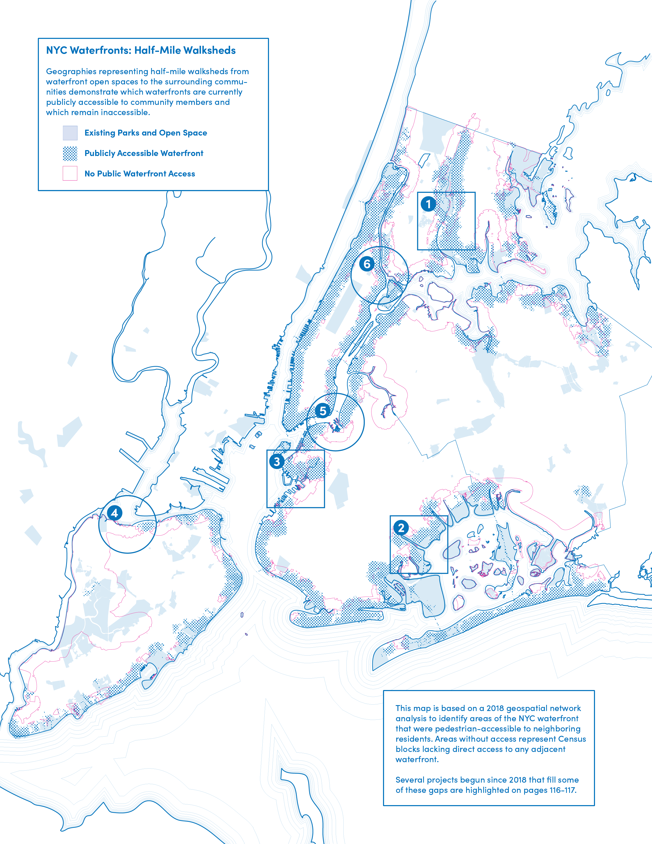
The NYC Comprehensive Waterfront Plan outlines a 10-year vision for a more equitable, more resilient, and healthier waterfront for all New Yorkers. The Plan contains visuals to highlight ongoing projects and proposals around the city. These urban plans help readers understand the breadth and depth of waterfront projects.
1. The Rockaways map shows projects and initiatives that will help communities manage increased flood risks and improve their quality of life. These projects include community farms, libraries, dune preserves, parks, housing developments and shoreline restoration.
2. The NYC Ferries Expansion Map displays new ferry routes and expansions across public and privately owned ferry lines.
3. The Equitable Public Access Map demonstrates inaccessible and accessible waterfront areas throughout the city. It highlights key project locations that will bring waterfront open space to underserved communities.
View the report at:
︎︎︎www.waterfrontplan.nyc